augmented reality
Name of the station: Lleida (listed building).
Date of inauguration: 30th May, 1860.
Author: Mireia Seguí Bru de Sala (student).
Origin and evolution
The plan to build the railway station of Lleida (the official name of the city at that time) formed part of the Ley de Ferrocarriles (Railways Act) of 1855. The relative peace of the period 1856-1863 facilitated the station’s inauguration in 1860, with it providing services for the Lleida-Manresa stretch of the Barcelona-Zaragoza line.
In 1861, the city of Lleida was connected to Barcelona and by 1865 connections had also been established with Tarragona and Reus thanks to the construction of a new line (see map 1). For the local inhabitants, the station of Lleida opened the doors for the expansion of their city. However, from 1863 onwards, some of the more negative implications of the rail connection became evident, with an increase in competition and in transport costs.
Initially, and until 1927, the station was located on the north side of the track (figure 1), but when a new, French style, building was constructed (figure 2) it was transferred to where it currently stands, which also facilitated the expansion of the city.
Figure 1: Initial location of the station of Lleida
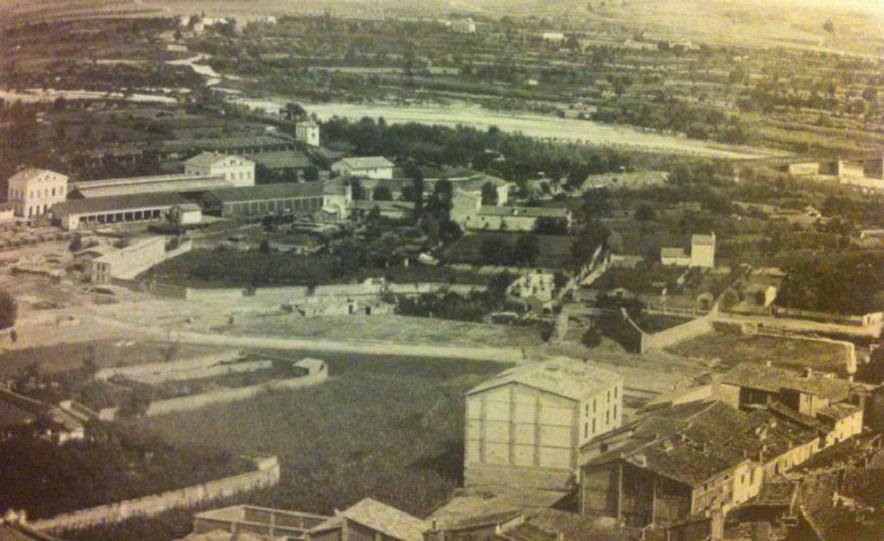
Source: Vice-Rectory for Cultural Activities and University Projection: 19th century Lleida. Photography. Pub: University of Lleida, Lleida, 2010.
Figure 2: The new station in 1949
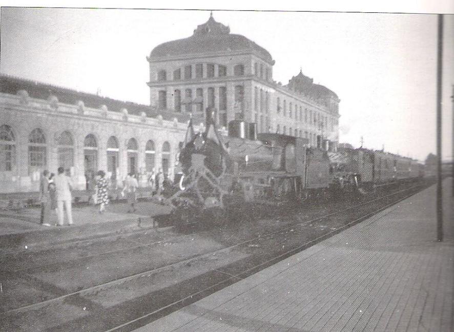
Source: NEBOT, A.: The Pobla de Segur Train. Pub: Ribera and Rius, Alcoletge, 1995.
With the arrival of the AVE (high speed train) in 2003, the railway station was extended and renamed Lleida-Pirineus (Lleida-Pyrenees) (figure 3).
Special features
The opening of the new station had an initially negative impact on the local economy due, above all, to competition from wheat imported from Aragón. This problem was further exacerbated by difficulties exporting local products once the lines that connected Lleida to Barcelona were extended to provide services to the industrial cities of Terrassa and Sabadell. All of this led to an increase in the cost of transport.
Environment
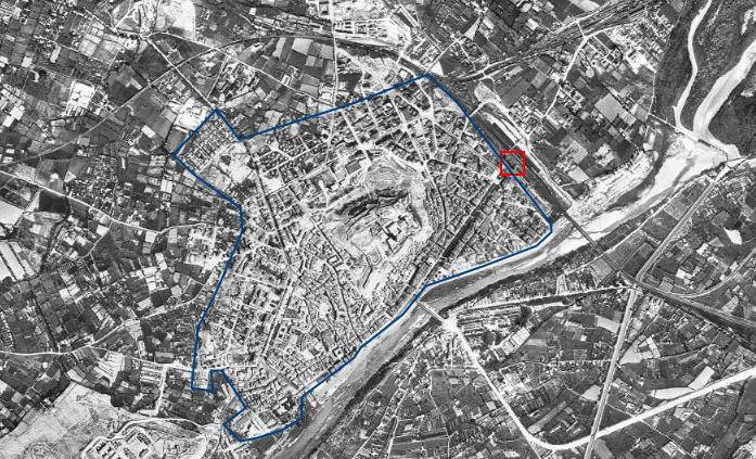
Figure 3 shows a plan of the city in 1869, shortly after the opening of the railway station. The city had already knocked down its walls, but the process of urban expansion had not yet begun.
Figure 3: Location of the railway station with respect to the city, 1869.
Source: BURGUEÑO, J.: Atles de les viles, ciutats i territoris de Lleida. Pub: Diputació de Lleida. Lleida, 2001.
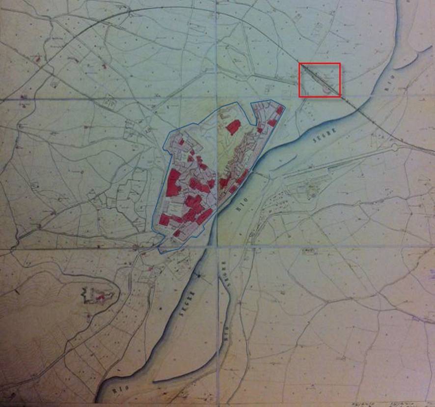
Figure 4 shows the location of the railway station with respect to the city in 1918. By this time, the main city had extended out to the railway station, which had effectively become an architectural barrier, as few constructions had been built beyond it.
Figure 4: Location of the railway station with respect to the city, 1918.
Source: LLOP, C.: Atles urbanístic de Lleida. Pub: Ajuntament de Lleida, Lleida, 1995.
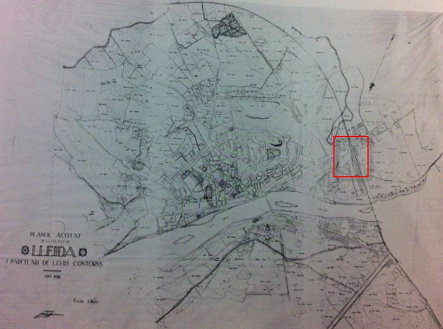
Figures 5 and 6 show the location of the railway station within the city in 1956 and 2012, respectively. In 1956, the railway line acted as a barrier to urban expansion, although a number of warehouses had been built on the opposite side of the track from the station. In contrast, by 2012, the railway station had become completely integrated within the city’s urban fabric.
Figure 5: Location of the railway station with respect to the city, 1956.
Source: ICC
Figure 6: Location of the railway station with respect to the city, 2012
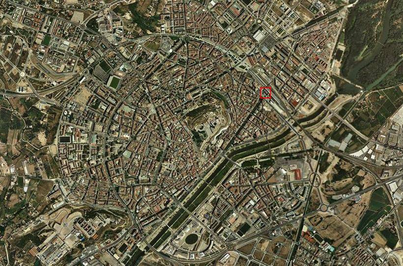
Source: ICC
Epilogue
The construction of Lleida’s railway station opened a new stage in the city’s history; this was accompanied by the demolition of the old city walls which opened the way for a new stage of expansion. However, in contrast with what had been expected, the arrival of the railway resulted in a reduction in the city’s exports due to the increased competition that this also implied. The railway station therefore brought with it an economic crisis.
Despite this problem, the railway station also represented a solution which, in the longer term, benefitted the city, leaving it better communicated with the outside world and able to exploit all of the benefits that this entailed.
Comments
Leave a Reply
How to use Augmented Reality (AR) in the classroom
1- Choose a topic to work on
Something close to your students that can be gelocalized (e.g. railway stations)
2- Organize a visit
Take your students to different locations and make them produce digital contents (e.g. pictures, videos, sound files)
3- Research
Make your students research on particular spots so they can complement the information they have generated
4- Create AR content
Make your students use an AR Content Mangement System (e.g. Hoppala) to associate the information to its geolocalization
5- Publish your AR content
Publish the AR content through an AR browser (e.g. Layar)
Seguir Leyendo